Scorched
I ate a traditional breakfast of cold oats and a Lil’ Debbie Cosmic Brownie, and set off quickly in hopes of catching Cookie Monster and Morning Star. About a half-mile past my makeshift campsite, the road ended in a big “tank trap”, a wide pile of dirt followed by a deep pit. Unfortunately, my instructions were to hike around it and navigate through a maze of overgrown, decommissioned road beds for the next few miles.
The old road beds were fairly passable for the first four miles or so. My pace was slowed by blowdowns, thick alder growth, tough navigation, and a few herds of cattle. I wound through the maze of decommissioned forest roads, checking my map and compass at every junction.
I filled up on water at a small spring (W430) before pushing on through the last couple miles of decommissioned roads. The last mile was the worst – an absolute jumble of downed trees. It became difficult to even find the road bed underneath the piles of logs, and every step forward was a puzzle. I lost my compass here… it probably fell out of my hip pocket while I was climbing over a log.
I was relieved when I finally made it to Deer Creek Summit (0434P). This meant two things: A pit toilet, and the end of the long roadwalk from Northport. I would be hiking on the Kettle Crest Trail until I made it to Republic.
However, there was a sign posted at the start of the Kettle Crest Trail saying that the first few miles of the trail were closed because of some chemical cleanup project… I think the danger was supposedly “flying debris”. Luckily, a forest road paralleled the trail for the first few miles, and the detour was fairly well-marked.
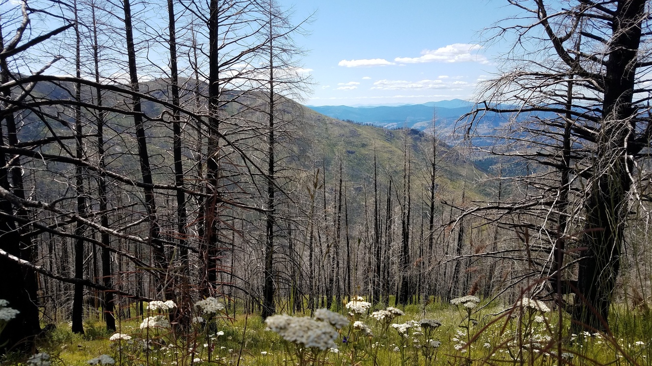
I joined back up with the Kettle Crest trail at a very confusing junction with unhelpful signage (0437P), but I saw Cookie Monster and Morning Star’s footprints leading the way. I was now in the heart of a swath of forest that had burned in 2015, surrounded by tall brush, overgrown wildflowers, and charred trees. I remember eating lunch against a big charred tree husk, the only spot of shade I could find in the eerily-bright forest. There were no leaves or pine needles to block out the intense midday sunlight, and I hiked in brutal heat for the next 9 miles.

The heat really started to wear on me into the late afternoon, but as I started climbing up a switchback, I saw two hikers in familiar wide-brimmed hats above me. I had finally caught up to Cookie Monster and Morning Star! I shouted at them from below, and they waited for me to catch up.
Morning Star and Cookie Monster looked just as hot and tired as I was. They convinced me that I needed to buy a hat. We stopped and talked for a bit, exchanged camping plans (we all planned to camp at the intersection with the Old Stage Trail), then I passed ahead of them. I felt renewed and refreshed, finally able to shake off the loneliness from the previous few days. On top of that, I was almost out of the 2015 burn area and into the 1988 burn area, which was filled with beautiful multicolored wildflowers and young pine trees.
My water source that evening was a spring-fed cow trough. It was impossible to move the pipe away from the trough, so I was forced to submerge part of my water bladder into the nasty, algae-filled cow water. The “spring” water was warm and still tasted like moss.
I settled down at the flat saddle where I planned to camp (0449P) and waited for Cookie Monster and Morning Star, who weren’t far behind me. We chatted over our respective dinners (boxed macaroni and cheese for me, a delicious home-cooked dehydrated stew for them) and went to sleep.